When the Earth Was Flat
"Map of the Square and Stationary Earth" ~ A Masterpiece of Pseudoscience

In 1893, Orlando Ferguson from Hot Springs, South Dakota, published a map of the Earth - which he claimed was flat, square and stationary. He asserted his model was supported by the Bible.
The map, titled "Map of the Square and Stationary Earth" shows the world as a circular depression in a square block, with a mound in the center representing the North Pole. The continents and oceans are distorted to fit this shape, and the South Pole is replaced by a jagged ring of ice that forms the edge of the world.
The sun and moon are depicted as lamps that rotate around the North Pole on curved arms. The North Star stays fixed above the North Pole.
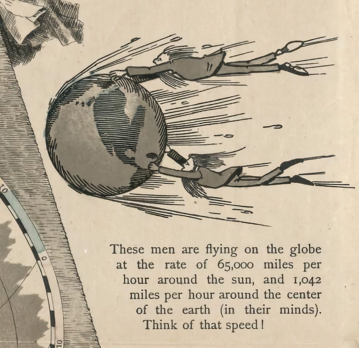
Ferguson asserted we couldn’t live on a spinning planet circling the Sun. To prove that point, his map included an illustration of people struggling to stay on an orbiting earth.
Ferguson also challenged anyone to prove him wrong by offering a $1000 reward to anyone who could demonstrate the curvature of the Earth or its motion. There’s no evidence he ever paid up.
Considering Pythagoras mused on the spherical Earth around 500 BCE, and that, by the Middle Ages, the prevailing view was that we live on a globe, 1893 seems pretty late in the game to be producing a map of the world as a square, stationary chunk.

But Orlando Ferguson wasn’t a lone voice. The 19th century had seen a resurgence of the flat-Earth movement. In the 1830’s, English writer Samuel Rowbotham did observations along the Bedford Canal (Bedford Level experiment) “proving the Earth to be a Plane.”
In 1885, William Carpenter of Baltimore published One Hundred Proofs that the Earth is Not a Globe. The list of not-quite-proofs includes “the Moon’s beams are cold” and “it is the star that moves.”
If you spend any time online, you won’t be surprised that Ferguson’s ideas persist - the “Flat Earther’s” are still among us.
The Flat Earth Society's most recent planet model is very similar to Ferguson’s - humanity lives on a disc, with the North Pole at its centre and a 150-foot-high wall of ice, Antarctica, at the outer edge. The resulting map resembles the symbol of the United Nations, which supporters use as evidence for their assertion. In this model, the Sun and Moon are each 32 miles in diameter.
Need more Pseudoscience?
Will Radium Restore Youth? (1923)
From the time Marie Curie and her husband Pierre discovered radium in 1898, it was quickly understood that the new element was no ordinary metal. It was soon viewed as a wondrous and powerful element: a cure for cancer, and a source of beauty and vitality. When the Curies finally isolated pure radium they determined that the substa…
Beyond Phrenology (1932)
The beauty micrometer, also known as the beauty calibrator, was a device designed in the early 1930s to help in the identification of the areas of a person's face which need to have their appearance reduced or enhanced by make-up. It was invented by the famed beautician Maksymilian Faktorowicz also known as
Kid's Radioactive Atomic Energy Lab Kit with Uranium (1950)
The Gilbert U-238 Atomic Energy Lab was an actual radioactive toy and learning set sold in the early 1950s. The $49.50 set came with four samples of uranium-bearing ores (autunite, torbernite, uraninite, and carnotite), as well as a Geiger-Mueller radiation counter and


Flat Earthers still exist, and yet they can go up in an airplane and SEE the curvature of the Earth!! 🤦♀️ At this point in time, it’s WILFUL ignorance. Prior to this, it *could* be lack of knowledge (though usually it was religion to blame, as it so often the case), but in these days of easily accessible information, there’s no excuse for not knowing something, except to be deliberately obtuse.
Come for the flat-earther fun, stay for the comments. I always love the comments on these. Bravo, people!