


Booklovers Map of America
Take a trip back to high school English

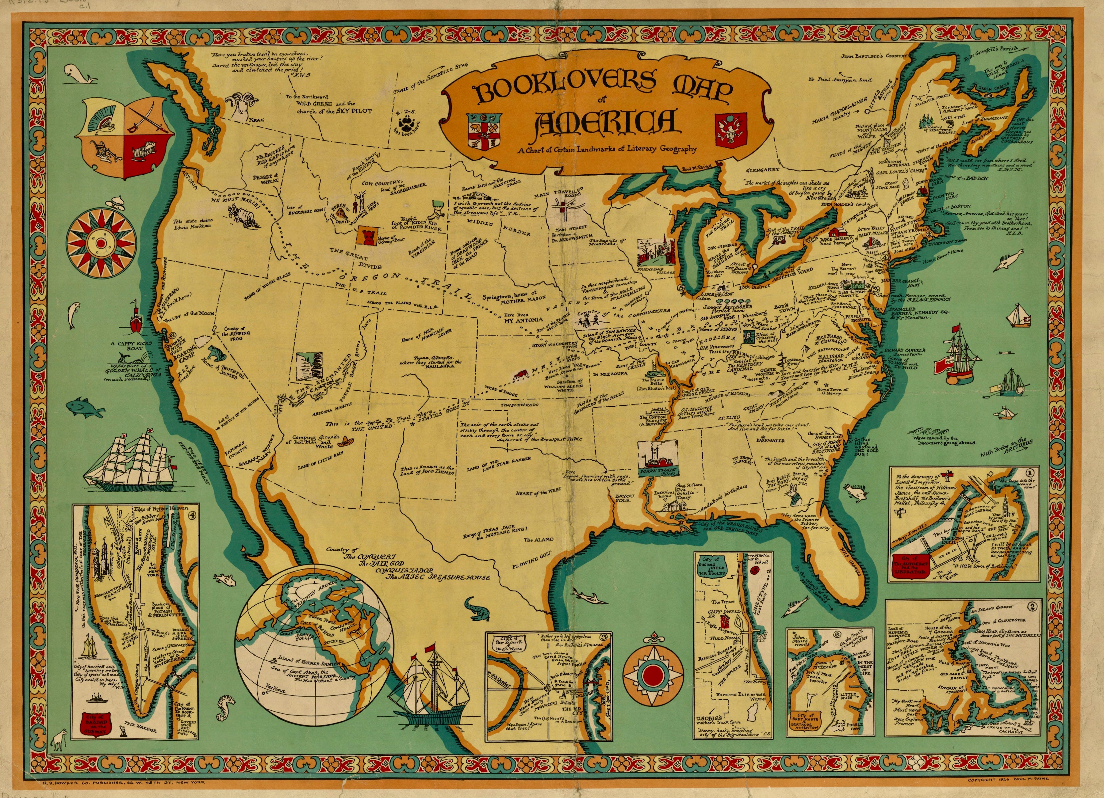
This “Booklovers Map” was designed by Paul Mayo Paine, who designed several pictorial maps during the 1920s and 1930s. He served as a librarian at the Syracuse [New York] Public Library from at least 1919 to at least 1931.
The pictorial map is dedicated to the locations which mark principal works of American literature. Novels whose plots take place in multiple locations, such as the Grapes of Wrath are indicated by dotted lines which trace the itinerary of the story.
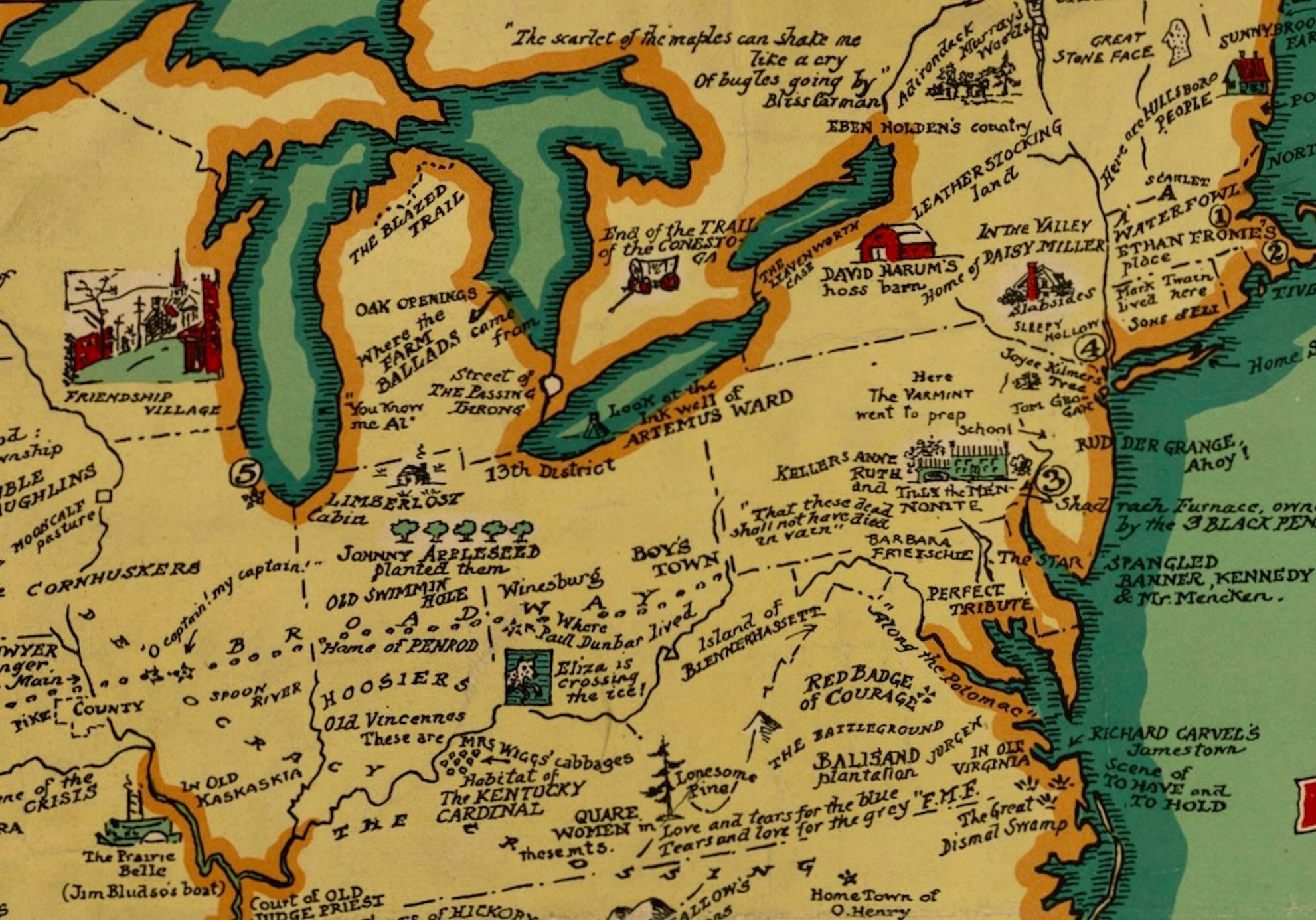
Countless literary works or folk legends are named in iconic vignettes including The Red Badge of Courage, The Virginian, Leatherstocking Tales, Sleepy Hollow and Paul Bunyan, with something of note remarked on each of the 48 states.
The map also includes the birthplaces and homes of several important writers. Insets around the outside of the map provide additional information about certain cities which have particular literary significance. ~ Vintage Map Shop
For more pictorial maps of America see:
Porcineograph (1876)

One of the rarest and most fascinating images of American comic cartography, "This Porcineograph" celebrates the American Union - and the pig! At the center is a map of the United States as a pig "copied from the Census Surveys of 1870, adding only 3 feet of territory (?) resting on Cuba, Mexico and the Sandwich Islands, and the Hydro-Cephalus from Cana…
A good-natured map of the United States setting forth the services of The Greyhound Lines (1939)

Colored pictorial map of the United States on sheet 30x48, folded into self wrapped cover 16x10. Date estimated. The Greyhound bus routes are shown in black, with interconnecting routes in dotted line, small pictographs highlight the attractions of places, and recreation along the routes. (on verso) text: travel information and vie…
When Paul Bunyan Got Cancelled (1953)

The map was intended as a bold celebration of America in the aftermath of victory in World War II - part of the effort to strengthen the nation at home and abroad. During World War II, the well-known Brooklyn artist William Gropper volunteered his services to the Treasury Department, illustrating posters -winning him a citation and …
Title: Booklovers map of America, a chart of certain landmarks of literary geography.
Creator: Paul M. Paine
Publisher: New York : R.R. Bowker Co.,
Date: c1926.
UM Clark Library Maps: 008393038
I'm pleased Astoria is the only Oregon town to make the book map. And suddenly I'm gripped with the desire to be a culinary tourist and explore me some US Geohography.
Perhaps you'd consider posting a Book Haters Map of America. PEN America published its Banned Books 2023 map back in April.