


The Comparative Area of Free and Slave States
A racism-fueled election on the eve of the Civil War

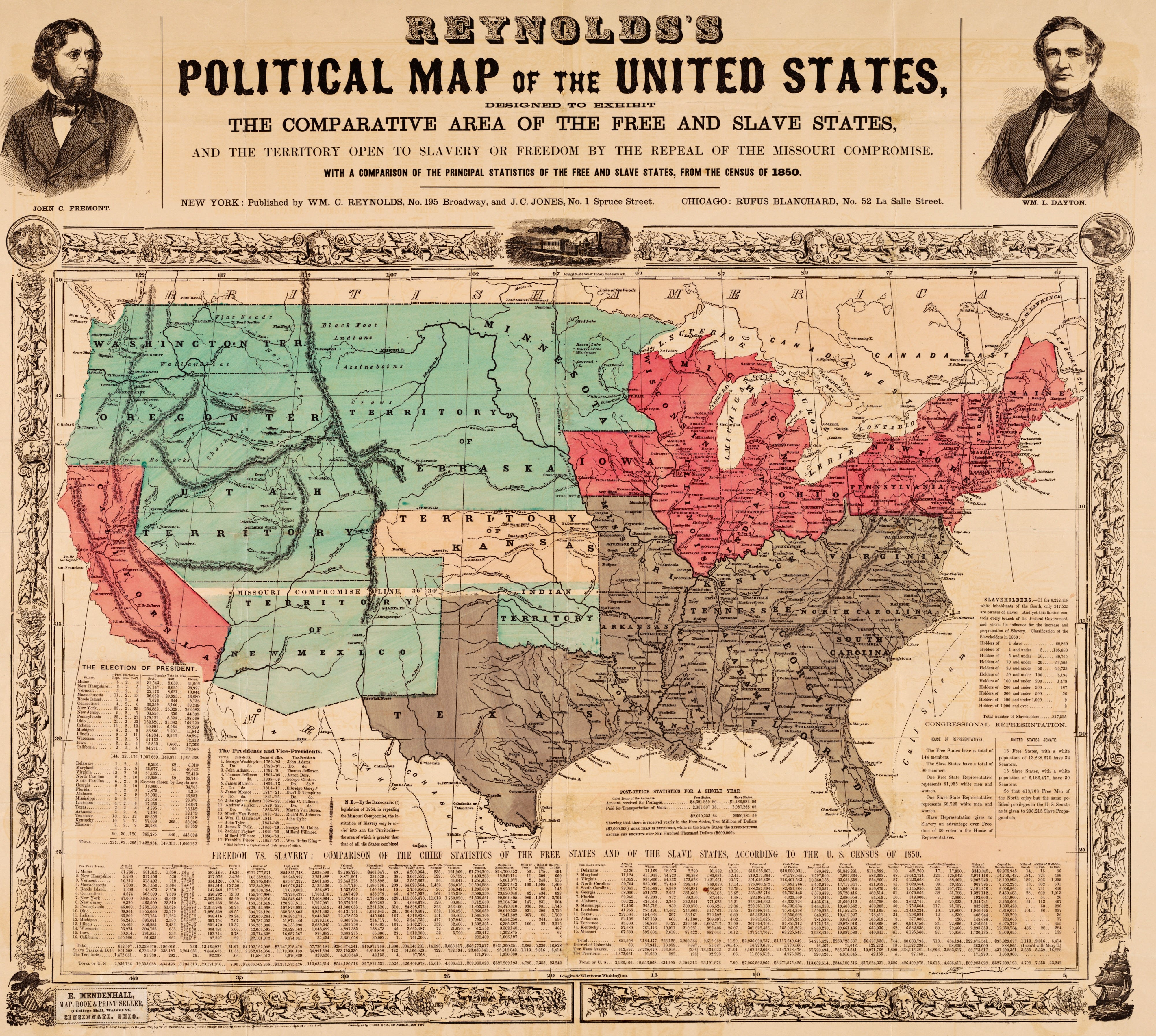
This landmark map supporting the candidacy of John Fremont played an important role in the 1856 Presidential election. It set out dramatically the stakes involved in the potential spread of slavery to the Western states, as stated in the legend below Texas: "N.B. - By the Democratic (!) legislation of 1854, repealing the Missouri Compromise, the institution of slavery may be carried into ALL the Territories - the area of which is greater than the area of all the States combined."
The map "startles the reader”, in part through a number of techniques found in persuasive cartography. The color of the western territories differs dramatically from the pink of the free states, giving the impression that slavery has already (or nearly) arrived in the west. The text on the map describes the existing unfairness of congressional representation and postal expenditures, both favoring the slave states.
The map is not based on the familiar Mercator projection; the meridians converge to the north, suggesting a Sinusoidal or Azimuthal/Orthographic projection. As a result, the relative size of the northern states is reduced and that of the southern states is increased, as if the globe is being viewed from above the southern states, foreshortening the northern ones.
The 1856 campaign was dominated by the question of whether or not to repeal the Kansas-Nebraska Act of 1854, which allowed new states the option to permit slavery. The Democratic candidate, James Buchanan, supported the Kansas-Nebraska Act. John C. Fremont, candidate of the new Republican party, opposed the Act, and maps like this one were an iconic feature of his campaign literature throughout, appearing in posters, handbills, pamphlets and the candidate's official campaign biography.
Title: Reynolds's Political Map of the United States Designed to Exhibit the Comparative Area of the Free and Slave States and the Territory open to Slavery or Freedom by the Repeal of the Missouri Compromise with a Comparison of the Principal Statistics of the Free and Slave States, from the Census of 1850
Alternate Title: Reynolds's Political Map of the United States
Collection: Persuasive Maps: PJ Mode Collection 2132.01
Creator: William C. Reynolds
Date: 1856
Now gerrymandering is done on a much smaller scale...but the effect is still the same.
WOW!