


Teaching Japanese Children to Support WWII
"The World Moving Toward a New World Order"

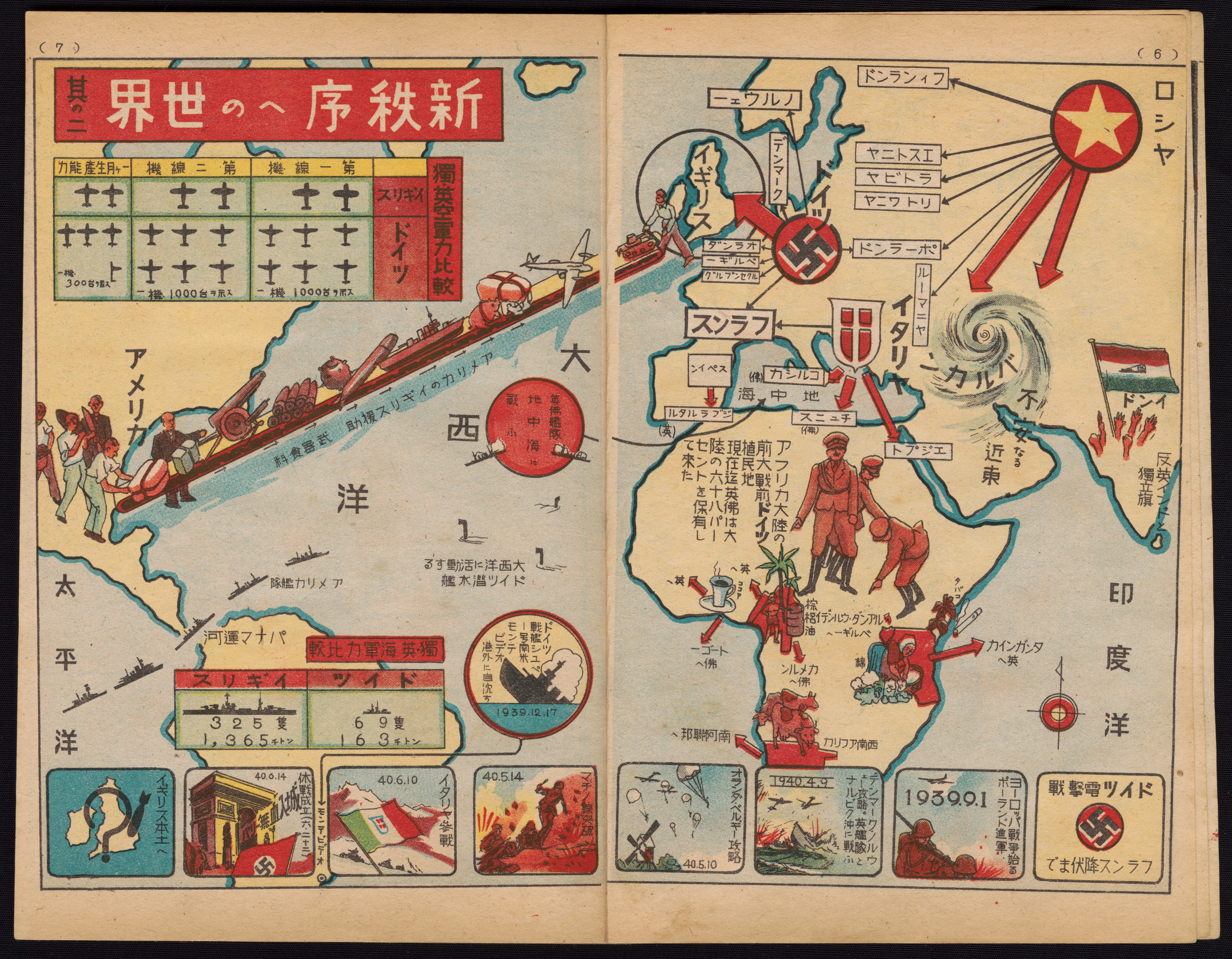
Atlantic view: This map is from a magazine published in Japan as part of the effort to engage and mobilize school children for the war effort. Germany's conquests are shown along the bottom from right to left: Poland, Denmark, Holland, Belgium, Norway, France - and then England with a question mark!
The conveyor belt in the Atlantic is labeled "America providing England support. Arms and food." Nearby is the label "German submarines active in Atlantic." Statistics compare British air power with (superior) German air power.
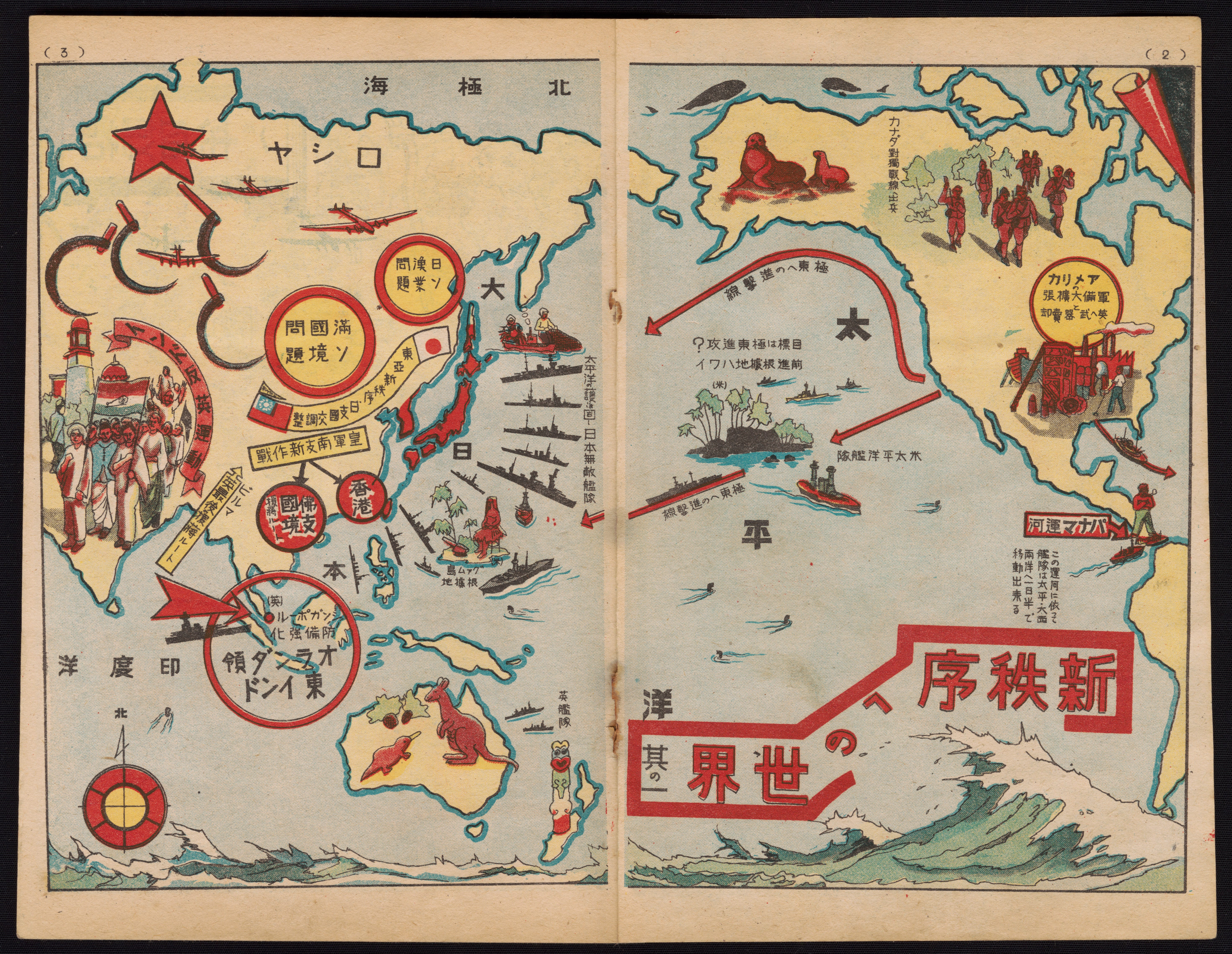
Pacific View: The curved arrow from the U.S. is labeled "Goal is to invade the Far East?" The line of ships in front of Japan is labeled "Japan is invincible."
Does the wave at bottom right echo Hokusai’s The Great Wave off Kanagawa?
A great number of these pamphlets were produced and distributed beginning in the mid-1930s. They contain patriotic Japanese military songs ("Gunka"), maps, photos of Japanese leaders, illustrations and other patriotic information. Carefully written and selected gunka were pervasive in Japan during the war years. Children sang them during any kind of group activity - outings, assemblies, physical training, on the way to and from school - and they were among the very few entertainment choices available to adults as well.
Title: The World Moving Toward a New World Order
Collection: Persuasive Maps: PJ Mode Collection Atlantic - 2166.05 | Pacific - 2166.03
Creator: Unknown
Date: 1940
Source: Schoolmates-Students on the Front Lines. July [?] 1940.
Um, well, I'm not sure the existing world order is something to celebrate but surely it's better than what that map envisions. And we ended up with all the cars and appliances and electronics anyway, right?