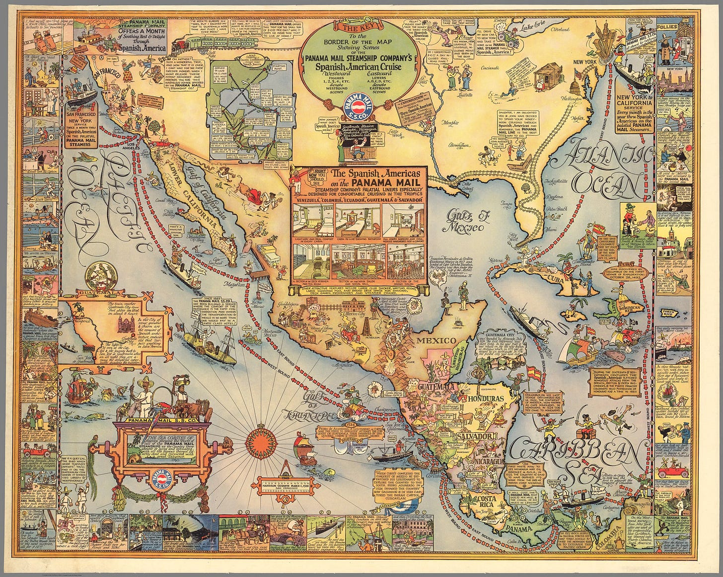
1928 pictorial map by Harrison Godwin promoting the routes of the Panama Mail Steam Ship Company. In Godwin's classic style, the map humorously covers North American from New York and San Francisco south to Colombia, including all of Central America, Mexico, and Cuba.
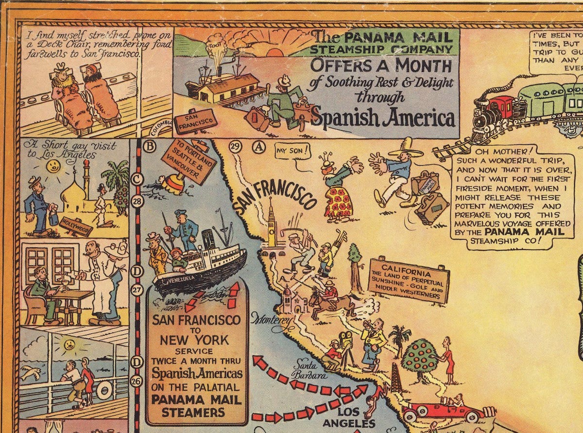
The map, detailing the Panama Mail Ship's route from New York, through the Panama Canal, to San Francisco, and the reverse trip. Along the borders the adventures of a fictional traveler are highlighted and include a two-day trip in Guatemala, watching a cockfight, meeting new friends on board the steamship, and exotic shipping in El Salvador and Havana, etc.
Throughout the map there are also numerous vignettes detailing historical and current events, as well cultural annotations. Other cartoonish vignettes in the United States follow several travelers and their families as they prepare for their Spanish American adventure.
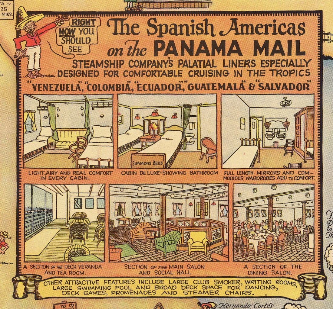
Smaller inset maps detail a two day excursion in Guatemala and Charles 'Lindy' Lindbergh's 1927-28 good-will tour through Latin America. At the center of the map a large inset details the luxurious accommodations available on board the Panama Mail Steamship. At top center: Key to the border of the map showing scenes of the steamship Company's Spanish American cruise.
Short Title: The Sea Coastes of America
Full Title: Panama Mail S.S. Co. The Sea Coastes of America shewing the Ports of call of the Panama Mail steamships as the Country there aboutes is lying and situated, with all the havens thereof. Exactly done and corrected with great diligence. Harrison Godwin, March 1, 1928 San Francisco.
Author: Harrison Godwin 1899 - 1984
Date: 1928
Publisher: Harrison Godwin
Publisher Location: San Francisco


Judging from the cartoon characters headed their way, they're the ones who should be building that wall.