


Mountains and Rivers: Line Up!
A pioneering infographic map

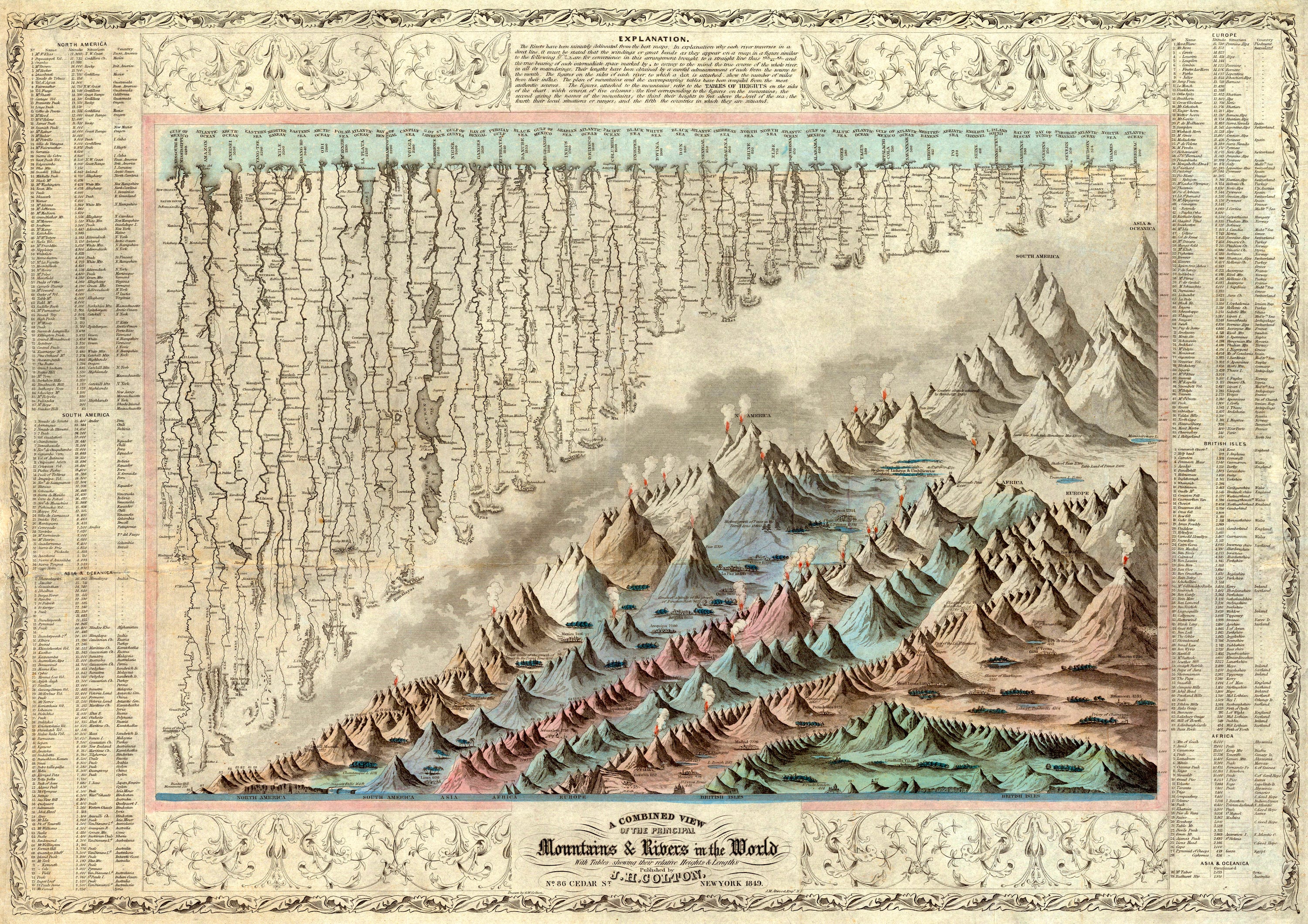
This pioneering map-based data visualization was published by J.H. Colton in 1849. Joseph Hutchins Colton (1800 – 1893), founded an American mapmaking company which was an international leader in the map publishing industry between 1831 and 1890.
To the right, the visualization focuses on major mountains arranged by height. Details include volcanic activity, notes on vegetation, and the altitude of selected cities and towns. Statistics on mountain heights fill the left and right borders.

Paired to the left are the major rivers of the world beginning with longest - to neatly fill the space left by mountain rankings. The rivers have been “straightened out” to focus on length and placement on the globe.
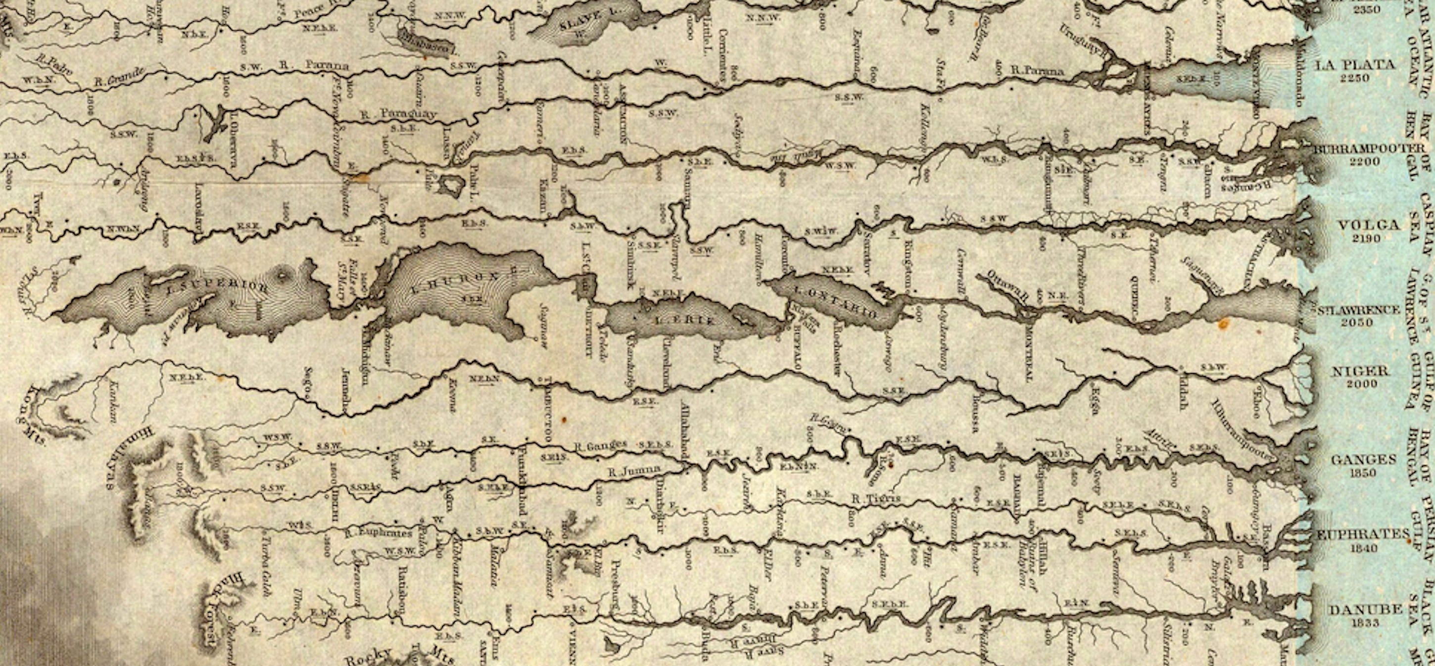
River’s close up below (rotated) - the US Great Lakes as lined up in a row.
J.H. Colton Company maps were printed using engraved steel plates, which produced higher quality prints than maps made with less costly wax engravings. They were often individually hand watercolored and were recognized for their decorative borders.
Colton map numerous locations in the United States and many foreign countries. ~ Wikipedia
A Combined View of the Principal Mountains & Rivers in the World - Visual Capitalist
I think my dad used that map on our family road trips.