


Moral & Political Chart of the Inhabited World (1831)
But beware of the savages

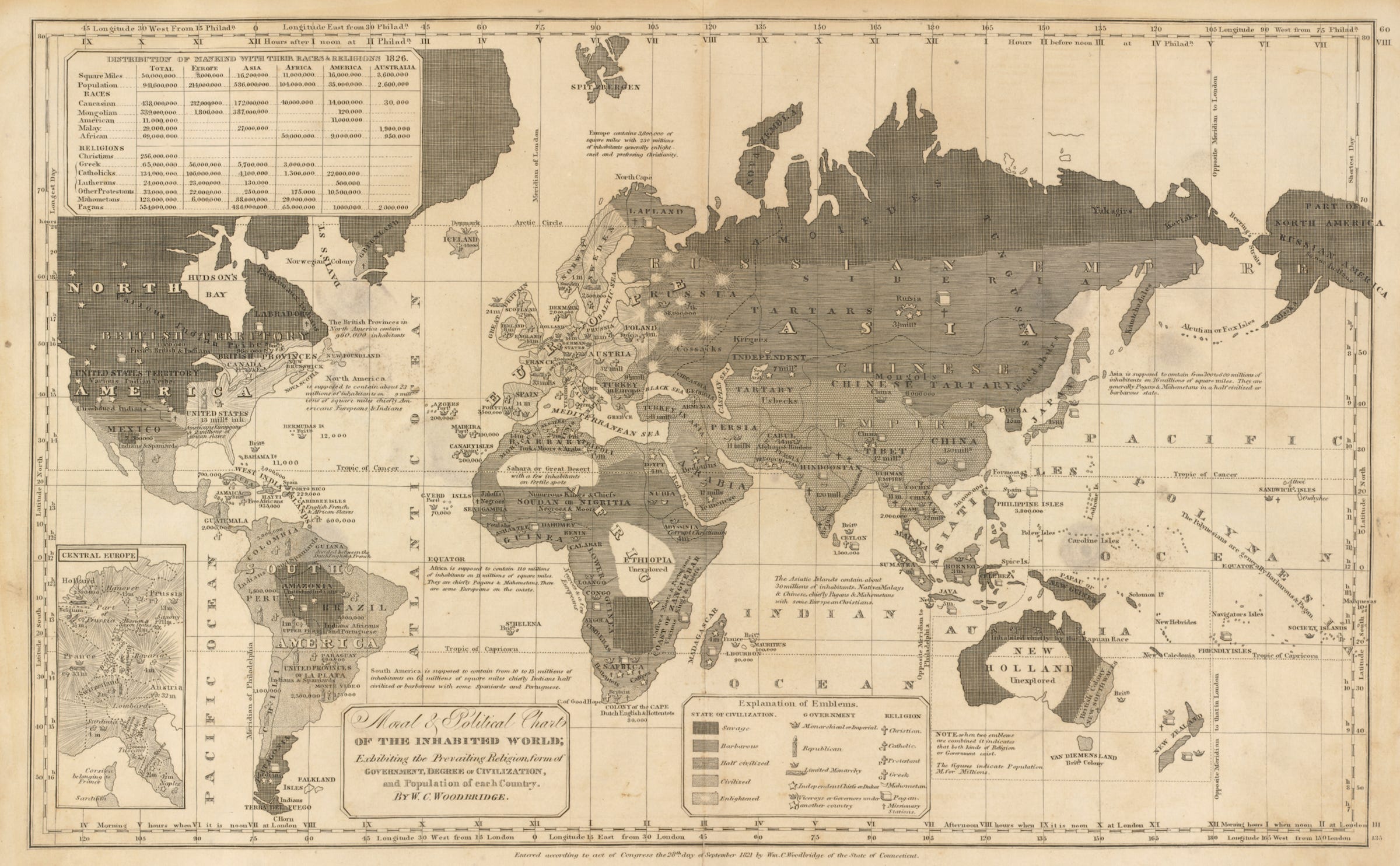
“Created by an obscure geographic educator of young women and the deaf from Connecticut named William Channing Woodbridge (1794-1854)…
… In September 1821 Woodbridge prepared and entered for copyright two somewhat similar maps, one of which was a Moral and Political Chart of the Inhabited World. That map was included in Woodbridge’s School Atlas, a companion for his textbook, Rudiments of Geography, co-authored with another geographic educator, Emma Willard. With the map, Woodbridge attempted to pull off a novel feat of cartographic pedagogy, one that classified the earth’s inhabitants by cultural hierarchies, i.e., religion, form of government, degree of civilization, and national population.
In looking at the map above, which is from the 1831 edition of the School Atlas, we initially are struck by the obvious tonal varieties and symbol shapes that spread across the globe. The world’s countries and regions appear to the eye as a variegated amalgam of black, greys, and whites, as well a curious combination of textures that apparently underlie some sort of code.
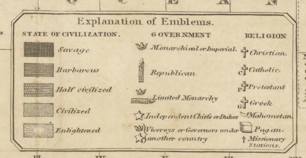
A closer inspection reveals that Woodbridge’s symbolism indeed is coded, as it equates ethnicity with levels of civilization and religion. His map divides the world into ethno-religious regions in which groups of people are identified as being in various stages of moral and political development. ..”
~ from When “Savages” Roamed the Earth: Maps Perpetuating Bias and Bigotry in the 19th century by Mike Klein, Senior Cartographic Specialist in the Geography and Map Division. Library of Congress."