


Korean View of the World (c 1874)
“Map of the world beneath the heavens”

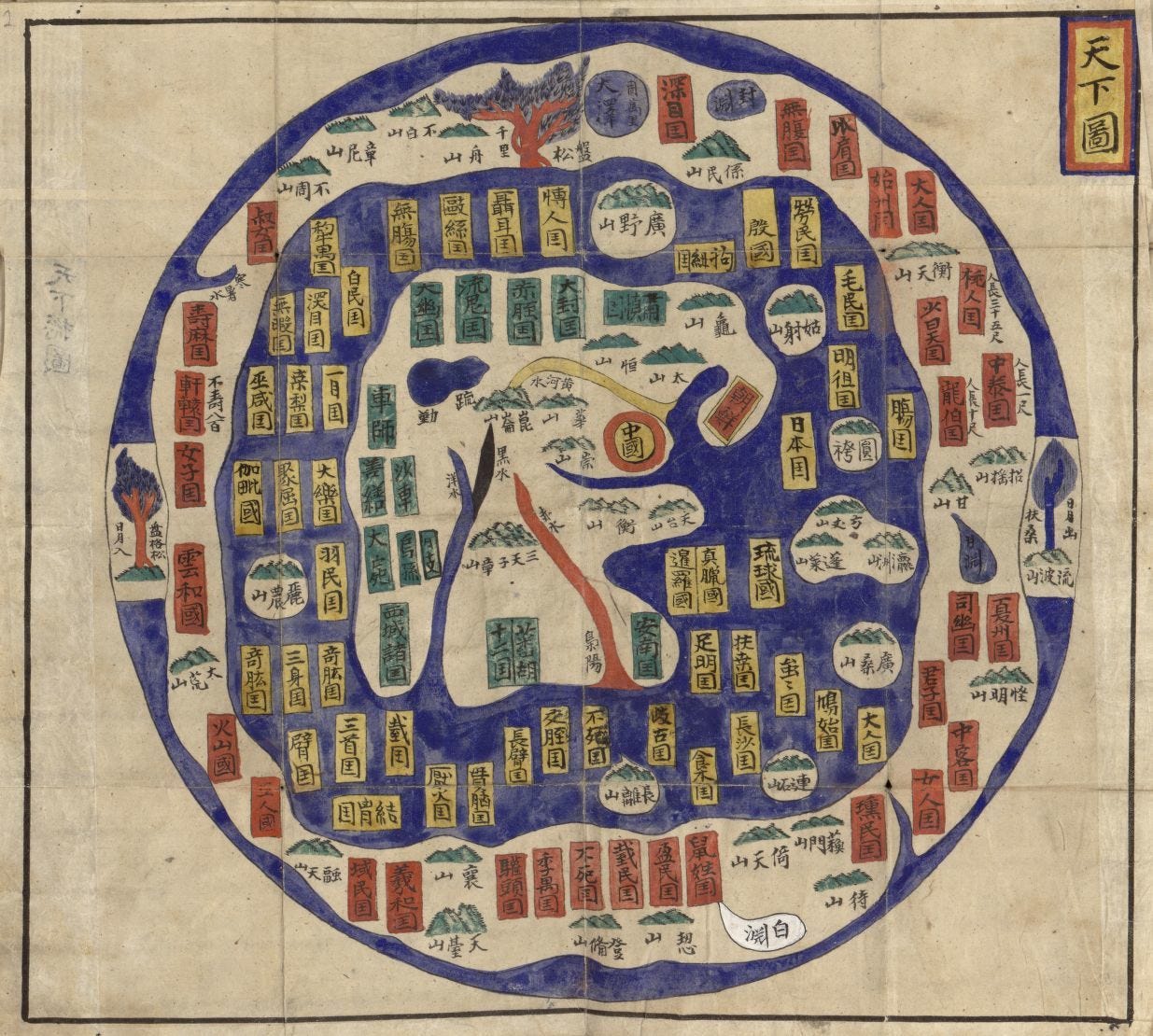
Ch’onhado is a type of Korean quasi-cosmographical depiction that means “map of the world beneath the heavens.”
Koreans developed this view in the 17th century, and it remained popular until the 19th century. Scholars debate its origins but agree that the perspective is uniquely Korean. It exists in many iterations and often was included in atlases.
Sino-centricity is an essential element of the Cho’nhado.
In the Tae Choson Chido, China is front and center, shown as a red circle with a yellow interior. Korea — known as Choson — is a yellowed-bordered rectangle with a red interior. To its right is Japan, pictured as a yellow rectangle.
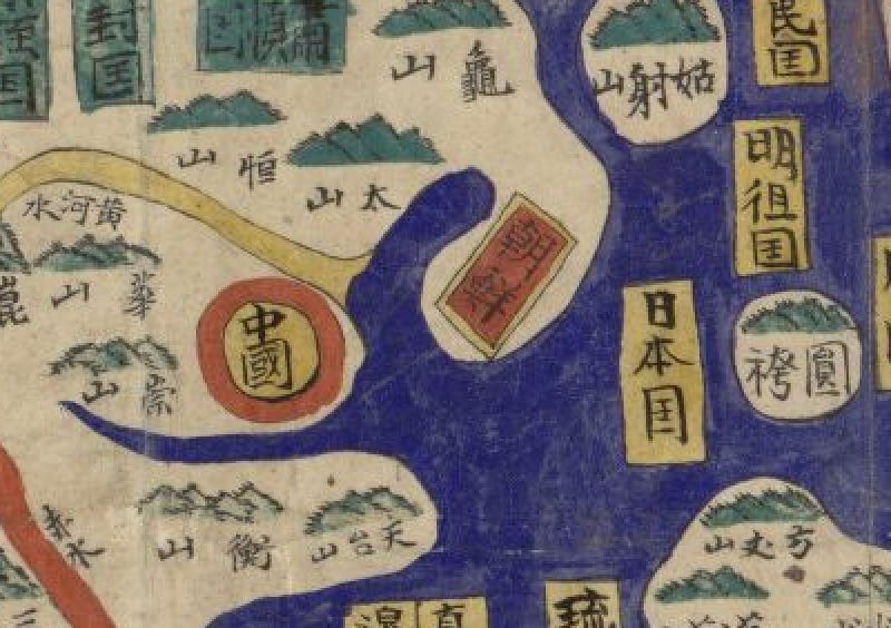
The proximity of these lands is relatively correct. The surrounding rings of land and sea, however, represent both real and mythological peoples and places, whose source was primarily classical Chinese literature.
One should not mistake Ch’onhado as prototypical of historical Korean cartography. It contrasts with historical Korean administrative maps that were based on direct observation and contain very recognizable geography. ~ Ryan Moore - senior cataloging specialist in the LOC Geography and Map Division. Library of Congress Magazine May-June 2021 issue.
Map source: Library of Congress: 84117124