


Discover the World with Australia's Flying Kangaroo
Vintage map puts Sidney at the center of the world

If you're feeling a bit nostalgic for the days of vintage aviation, take a look at this iconic poster and be transported back to a time when flying was a true adventure.
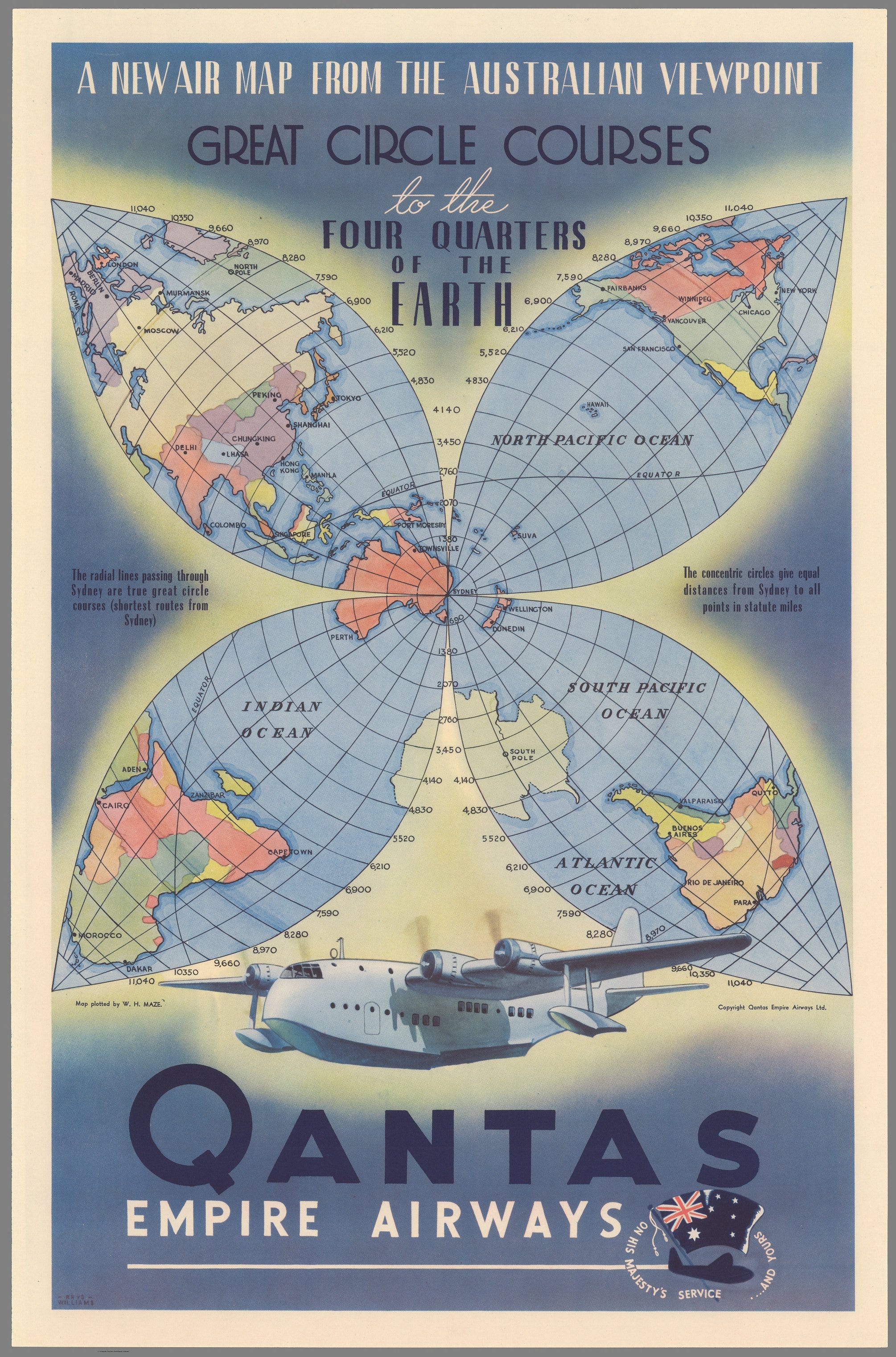
Designed by the legendary Australian commercial artist, Rhys Williams, this colorful poster showcases Qantas' global reach with a map of the world laid flat and divided into four areas.
The concentric circles highlight the flight paths from Australia, including the Southeast Asia to Europe route on the top left, the North Pacific Ocean and USA route on the top right, the Indian Ocean and Africa route on the bottom left, and the South Pacific Ocean and the Atlantic Ocean and South America route on the bottom right.
Sydney, where the first Qantas flights departed from, takes center stage in the map. Qantas - known as the "Flying Kangaroo" - is the second oldest airline in the English-speaking world, founded in 1920 as Queensland and Northern Territory Aerial Services Ltd. (From which the name Qantas was derived)
A graphic of a C class flying boat hovers over the company title, reminding viewers of the important role these aircraft played in maintaining links between Australia and the UK during the Second World War. They were even converted into military aircraft or employed to carry supplies. Many Qantas commercial pilots were even taken into the RAAF.
Author: Rhys Williams (1894-1976)
Author: W.H. Maze
Date: 1938
Short Title: Qantas Empire Airways. A New Air Map from the Australian Viewpoint. Great Circle Courses to the Four Quarters of the Earth.
Publisher: Qantas Empire Airways, ltd.
I live in a condo and don't have a lawn but I still yell at children. Is that wrong?
Flying kangaroos are a scary concept but I pine for the days when flying was a true adventure. And you didn't have to pay to check your bags. And you could eat the food.