


Beware the Russian Octopus
Long before the invasion of Ukraine, Europe feared Russian aggression.

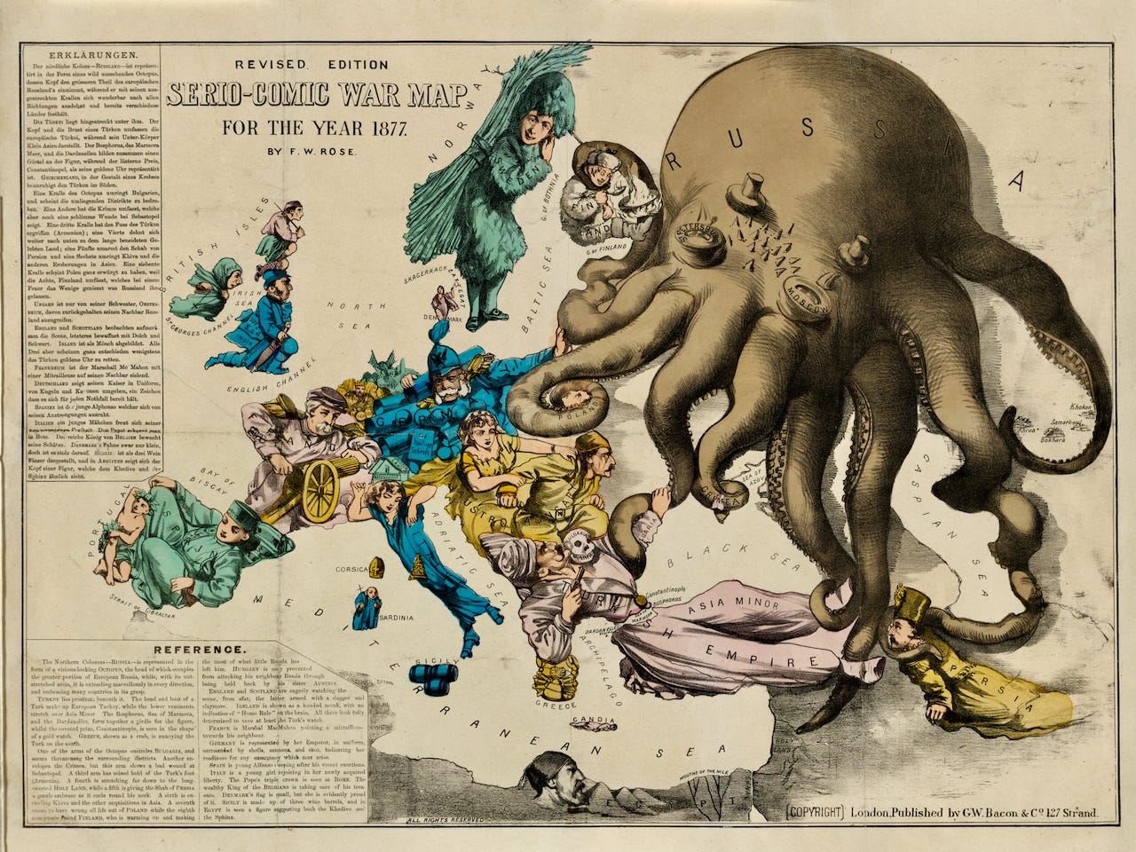
Frederick Rose’s dramatic “Serio-Comic War Map for the Year 1877” arose out of the Russo-Turkish war. When Russia invaded Turkey in 1877, the Conservatives under Prime Minister Disraeli were concerned; they saw the Turks as an important counter- weight to Russian territorial expansion. In particular, they feared the capture of Constantinople, which would have given Russia a warm-water port on the Mediterranean uncomfortably close to the new Suez Canal.
Rose was a longtime British civil servant who supplemented his income by contributing caricatures to newspapers and journals. A dedicated Tory from his teenage years, he was active in local Conservative organizations and politics.
His map quietly acknowledges the slaughter (the “Turkish Empire” figure holds a gun to a “Bulgarian” skull), but it is dominated by a giant Russian octopus whose tentacles threaten the world from Finland and Poland to the Balkans and Persia. Detailed legends on the map explain the positions of the great powers and affected countries.
This map was a runaway success, published in many editions not only in Britain but across Europe and in the U.S.
Although the Russians won the war and achieved gains in the Balkans, the threatened intervention of British warships kept Constantinople out of Russian hands, and Britain gained control of Cyprus to strengthen its hand in the eastern Mediterranean.
The Octopus map (as it quickly became known) combined pictorial and satirical illustration with extensive text and bold use of color. The cartographic octopus as a symbol of evil grasping—now “an internationally recognized visual propagandist trope”—has been used in many satirical maps of territorial expansion and war.
~ Not Maps At All” –What Is Persuasive Cartography? And Why Does It Matter? by PJ Mode
For more satirical maps on Russian aggression see:

Title: Serio-Comic War Map For The Year 1877. Revised Edition.
Creator: Frederick W Rose
Publisher: G.W. [George Washington] Bacon & Co., publisher
Date: 1877
Collection: Persuasive Maps: PJ Mode Collection: 2272.01